

The Hikes
At the heart of our retreats is hiking - not only as an activity, but as a way to slow down, be present, and experience Provence more deeply. These hikes are for nature lovers, keen walkers, and also those who simply feel drawn to spend time outdoors and discover the beauty of the region for the first time.
Over the course of three days, you will explore some of Provence’s most beautiful and varied landscapes, following winding trails through forests, past wild lavender, wildflowers and fragrant herbs, and up to high, open viewpoints. Away from the crowds, the experience becomes less about rushing from one place to the next and more about properly taking in your surroundings - the light, the scent of the landscape, the mountain air, the stillness, and the sense of space.
Across the retreat, we enjoy a variety of hikes, carefully chosen to suit the group and create a balanced and rewarding experience. This region offers an exceptional range of routes. Hikes will include some steep climbs, steep descents, and altitudes of up to around 1,700 metres.
What makes these hikes so special is not only the scenery, but the way they allow you to feel immersed in it. There is time to walk, pause, look around, and enjoy the landscape in a more mindful way - leaving you feeling energised, grounded and connected to the natural world around you.
Our hikes take us through several distinct landscapes, each with its own character and beauty.
The Alpine Region
To the north, across the Var and Alpes-Maritimes, the scenery becomes more rugged and expansive. Here, hikes lead through alpine forests, rocky mountain terrain, open lavender fields and panoramic ridgelines, with far-reaching views over the southern Alps and all the way to the Mediterranean.
The Red Rock and Hill Country
Further south, the landscape changes dramatically. In this part of the Var, volcanic red rock formations, rolling hills, forested valleys and striking geological features create a very different atmosphere - warmer, more Mediterranean, and rich in colour and texture.
Around the Villa
Closer to the retreat base, there are beautiful trails that reveal the quieter charm of the local landscape. These walks lead through woodland, alongside rivers, and into the gentle hills surrounding the villa, offering a wonderful sense of calm and a rich variety of flora and fauna.
The routes shown below are the full versions of some of our featured hikes. Depending on the group, the weather, and the overall rhythm of the retreat, many of these can be shortened or adapted to create the experience that feels right for everyone.
For more detailed information about the hiking options, please get in touch. We are always happy to tailor the experience so that it suits your group, your level, and the kind of retreat you are looking for. Below, you will find a selection of route maps and images that give a sense of the landscapes, trails and views that shape our hiking retreats in Provence.
Whether you are an experienced hiker looking for inspiring new experience, or simply someone who feels at their best in nature, these hikes offer a beautiful way to experience a quieter, more unspoilt side of Provence.
-
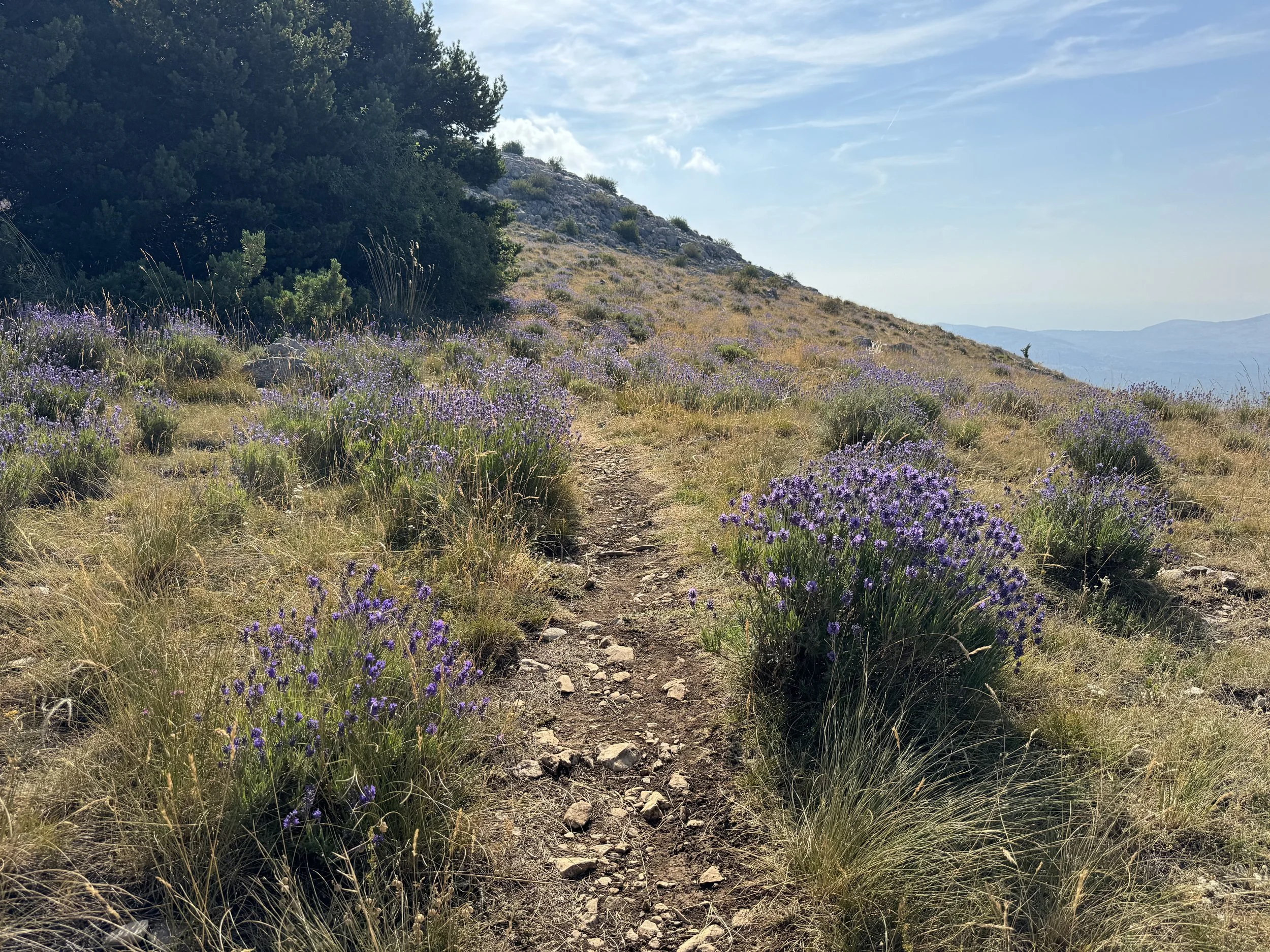
![A dirt trail winds through a hillside covered with purple flowering plants and grasses, with trees on the left and a view of distant mountains under a partly cloudy sky.]()
Wild Lavender Fields
-
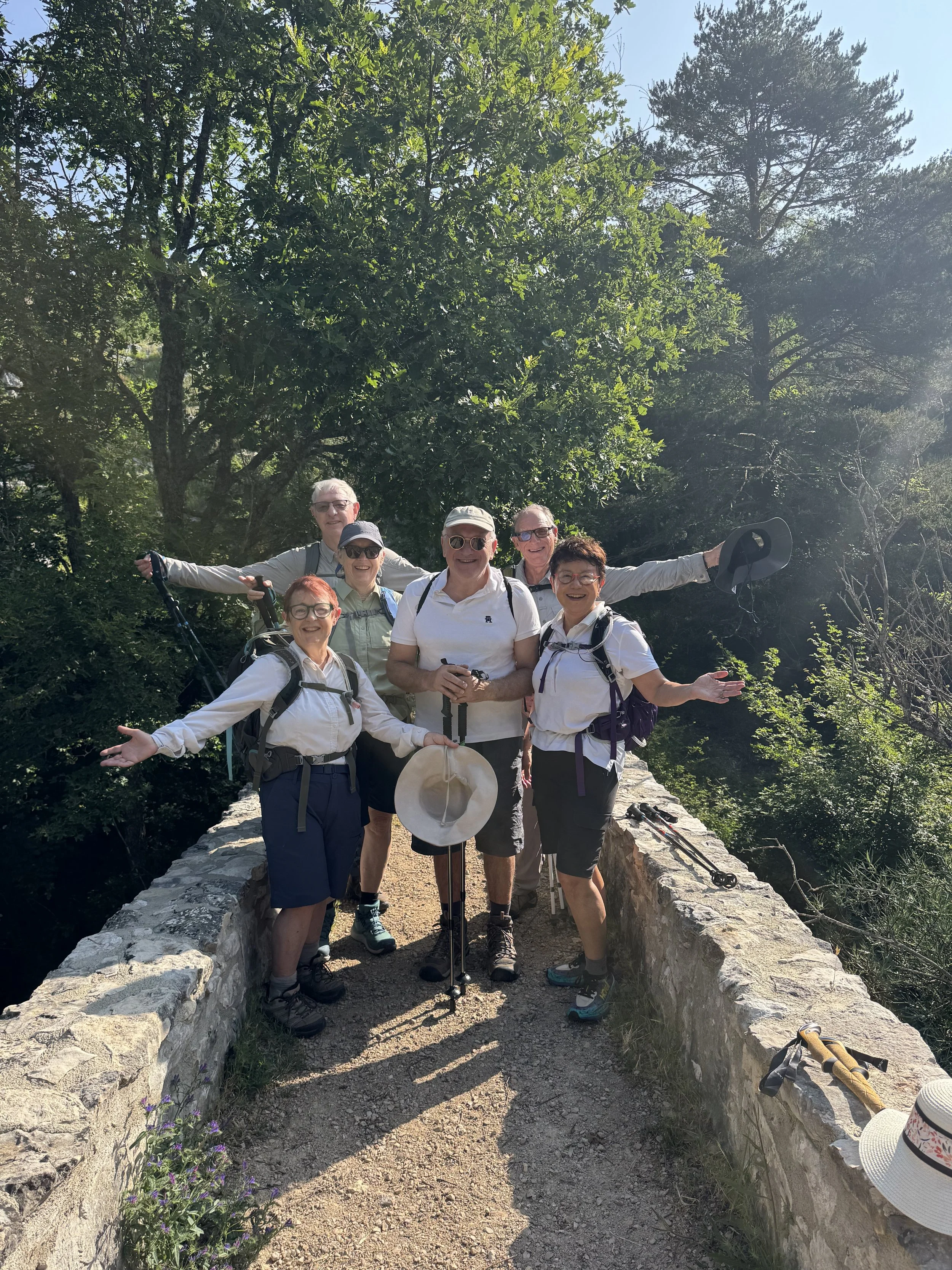
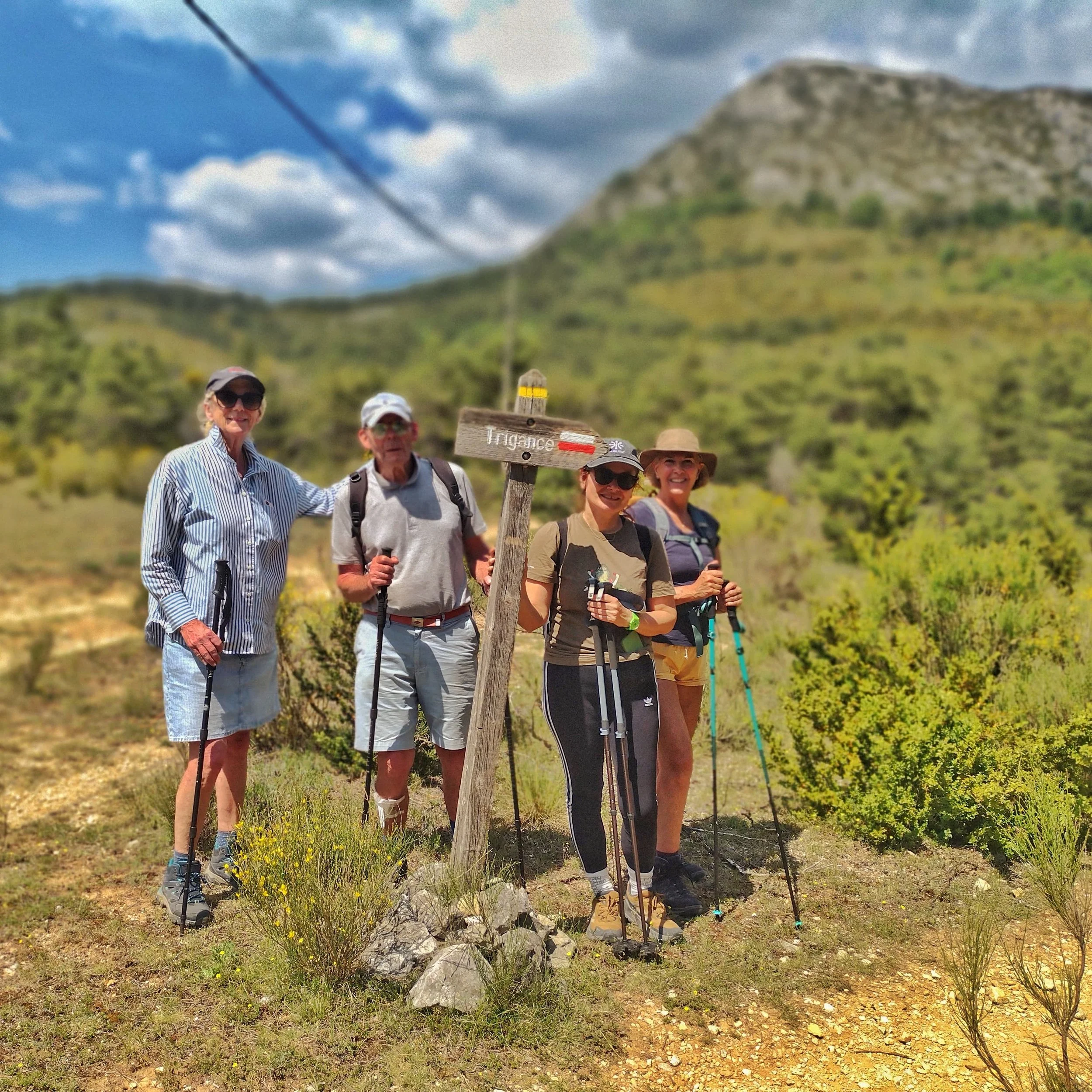
![A group of six older adults smiling and posing on a stone bridge in a wooded area on a sunny day, dressed in outdoor hiking attire, with some holding hiking poles and hats placed on the bridge.]()
Hiking Group
-
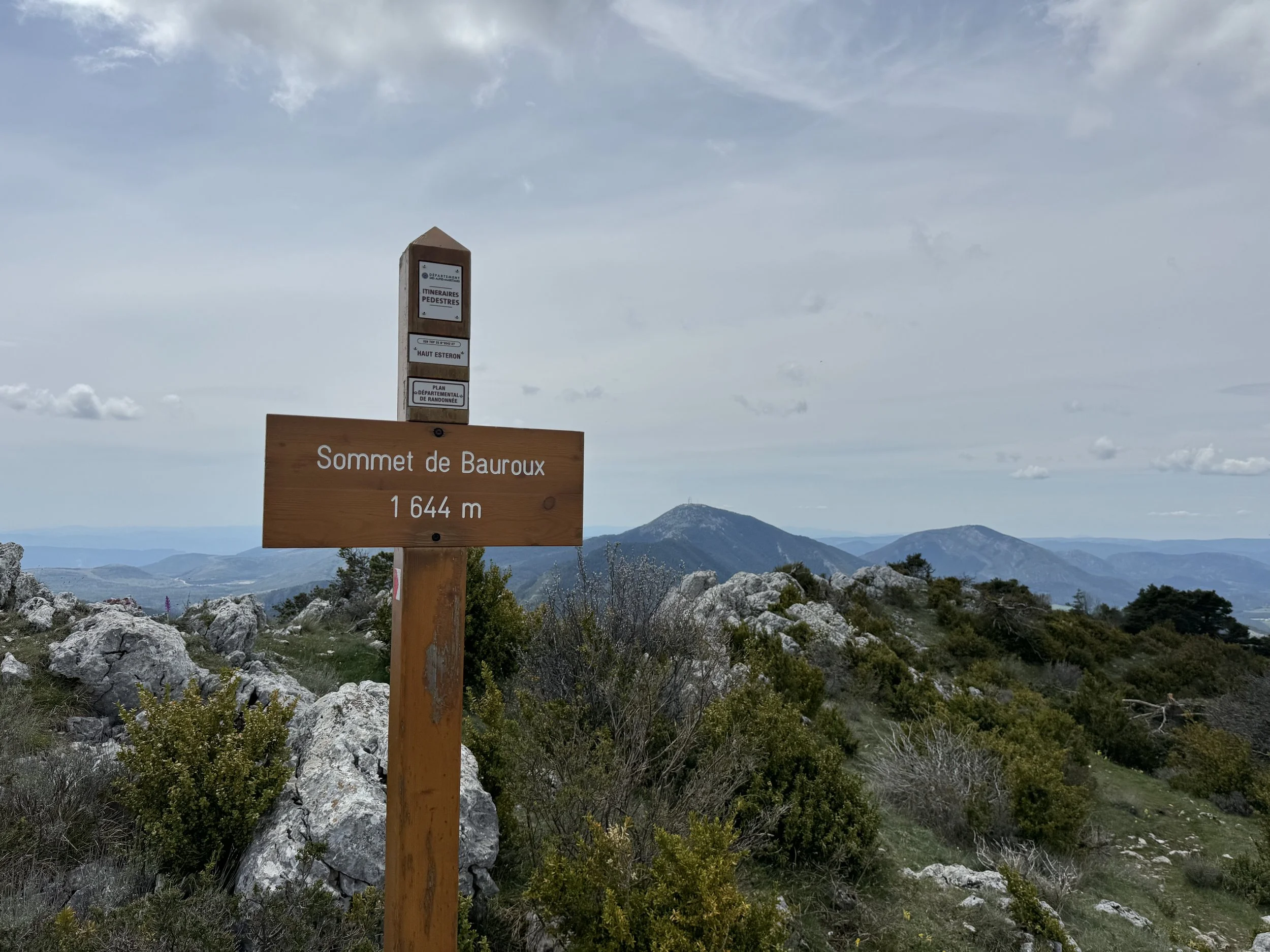
![A wooden sign on a mountain trail indicating the summit of Bauroux at 1644 meters elevation, with a mountainous landscape and cloudy sky in the background.]()
Bauroux Mountain Summit
-
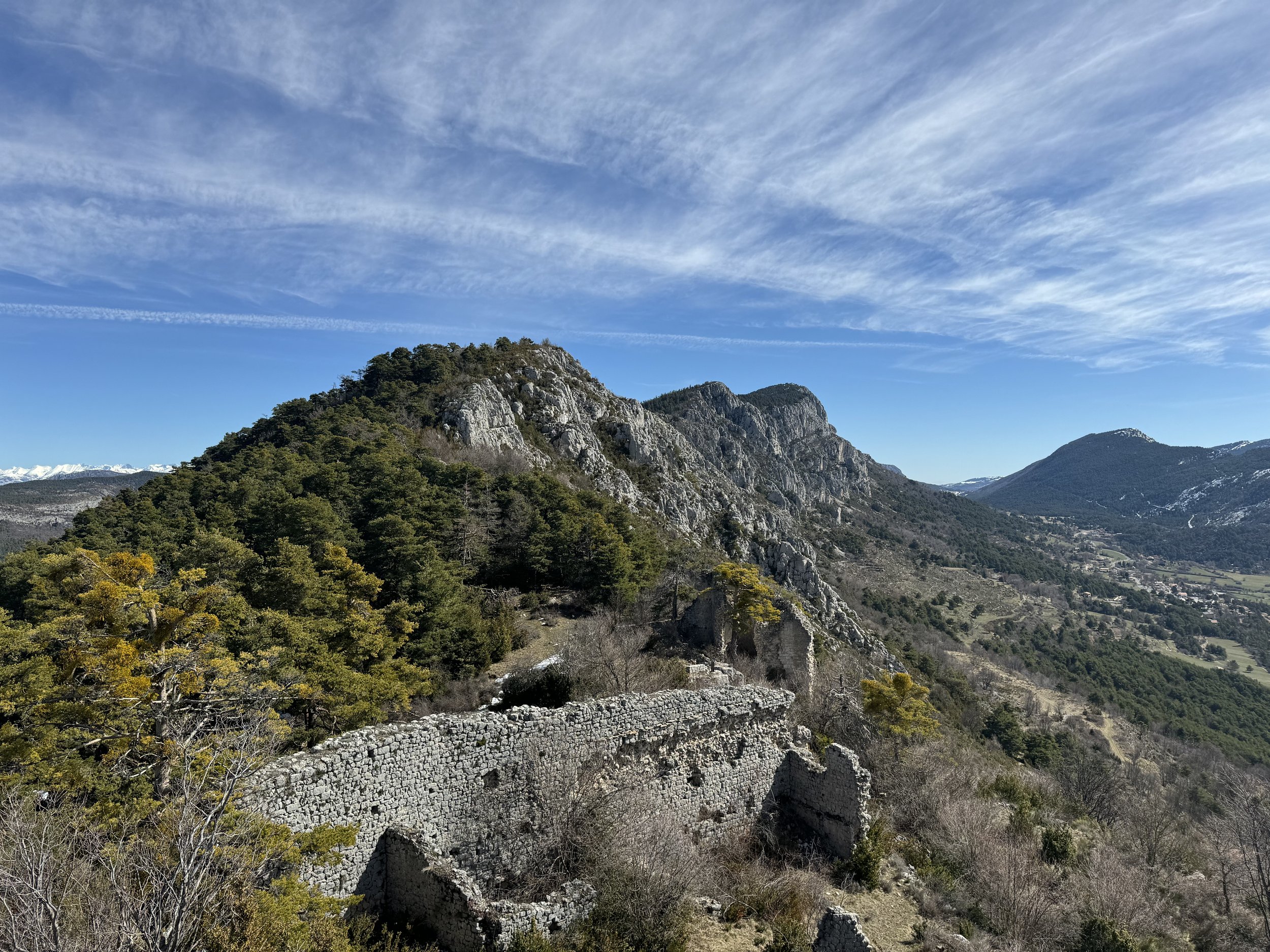
![Mountain landscape with green trees, rocky cliffs, and ancient stone ruins under a blue sky with wispy clouds.]()
Views of old village ruins on Bauroux Mountain Trek
-
![Group of eight hikers outdoors in a forested area, smiling and posing for a photo, dressed in outdoor gear with backpacks and trekking poles.]()
Hiking Group
-
![A scenic view of rocky red cliffs and green trees under a blue sky with clouds.]()
Gorges du Blavet Trail
-
![Aerial view of rugged mountain landscape with rocky cliffs and green vegetation, extending into distant mountain ranges.]()
Bauroux Mountain
-
![Aerial view of lush green mountains with winding roads and a small village in the valley.]()
View of Lachens Mountain
-
![Scenic view of rolling green mountains under a clear blue sky with the sun shining brightly on the left side.]()
Local Scenery in the Morning
-
![A group of older adults with hiking gear, standing outdoors on a trail in a hilly area, near a mountain, under partly cloudy sky, with some holding hiking poles.]()
Group
-
![Mountain landscape with rolling hills and rocky ridges under partly cloudy sky.]()
Mountain Ridge
-
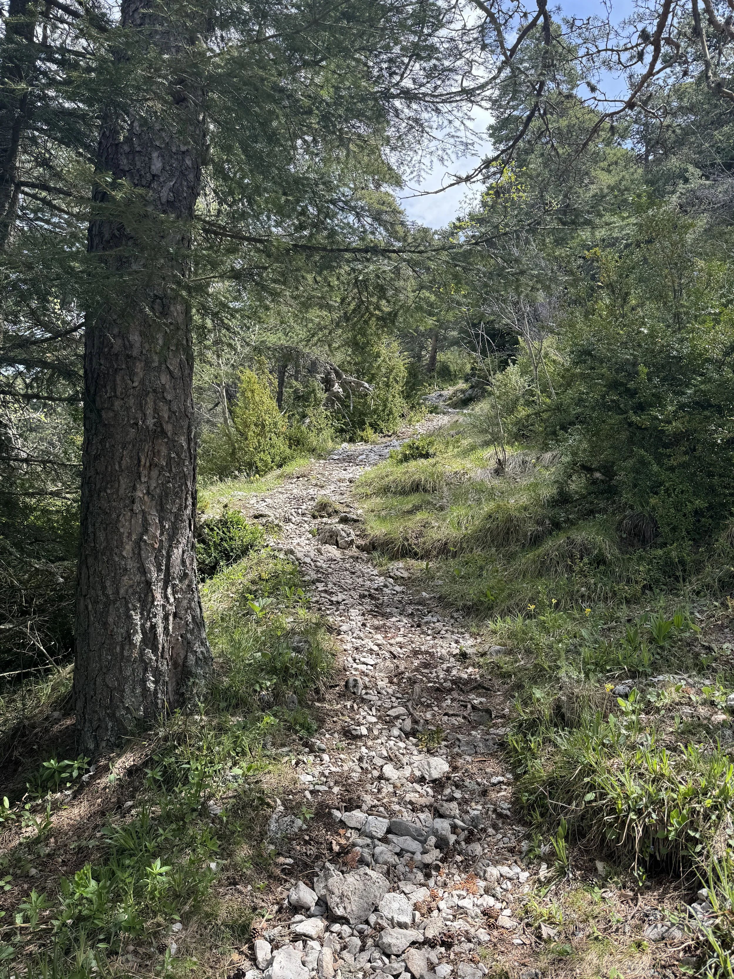
![A rocky dirt trail through a forested area with tall trees and green shrubs.]()
Trail on Bauroux Mountain Trek
-
![Mountain peaks with rocky slopes and sparse vegetation under a partly cloudy sky.]()
Cheiron Mountain
-
![A hillside with yellowed grass and purple wildflowers, bordered by trees under a clear blue sky with the sun shining.]()
Wild Lavender Fields on Lachens Mountain Trek
-
![]()
At the top of Lachens Mountain
-
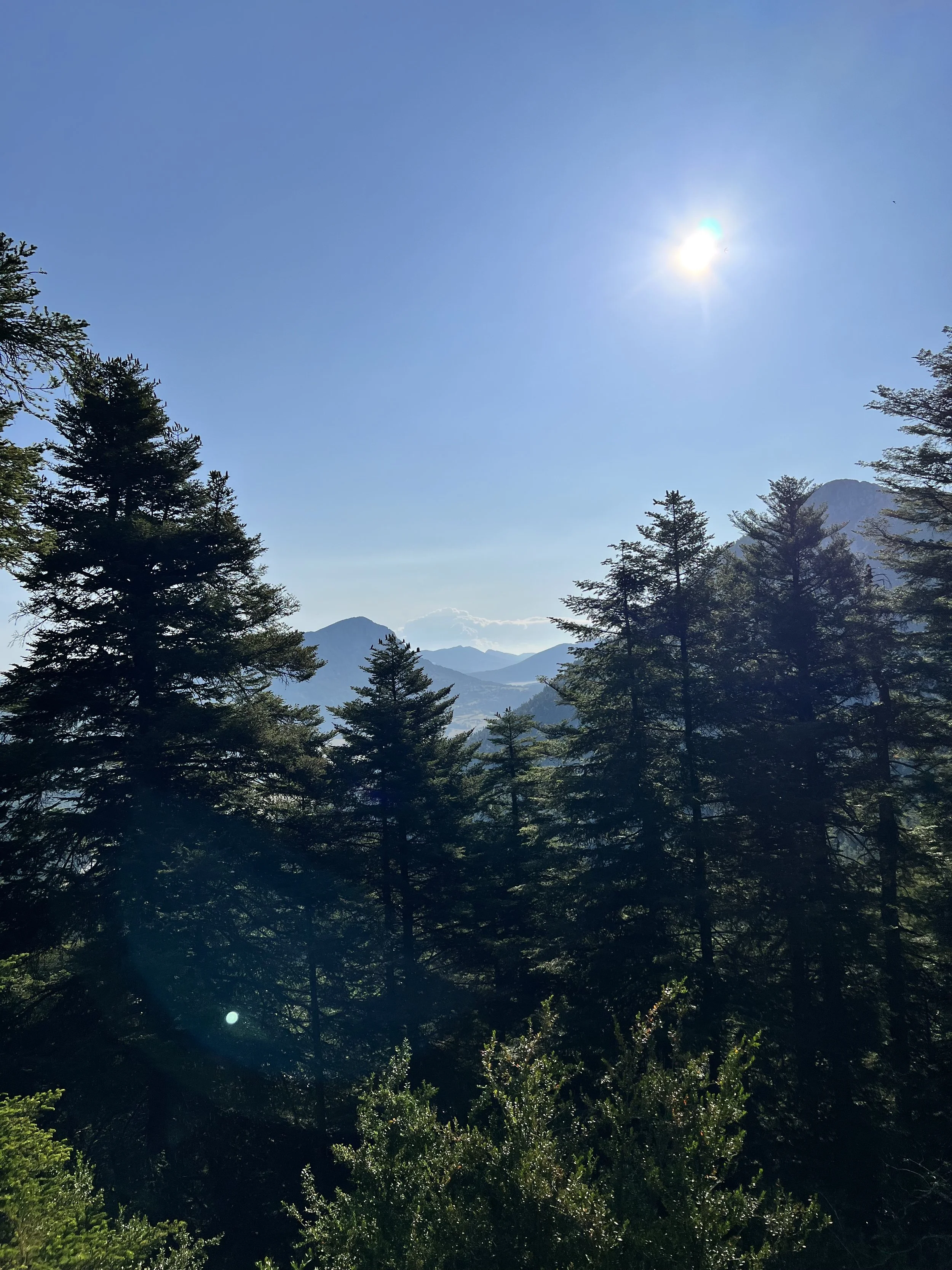
![Sun shining over a mountain valley with tall evergreen trees in the foreground under a clear blue sky.]()
Pine Forest near Cheiron Mountain Trek
-
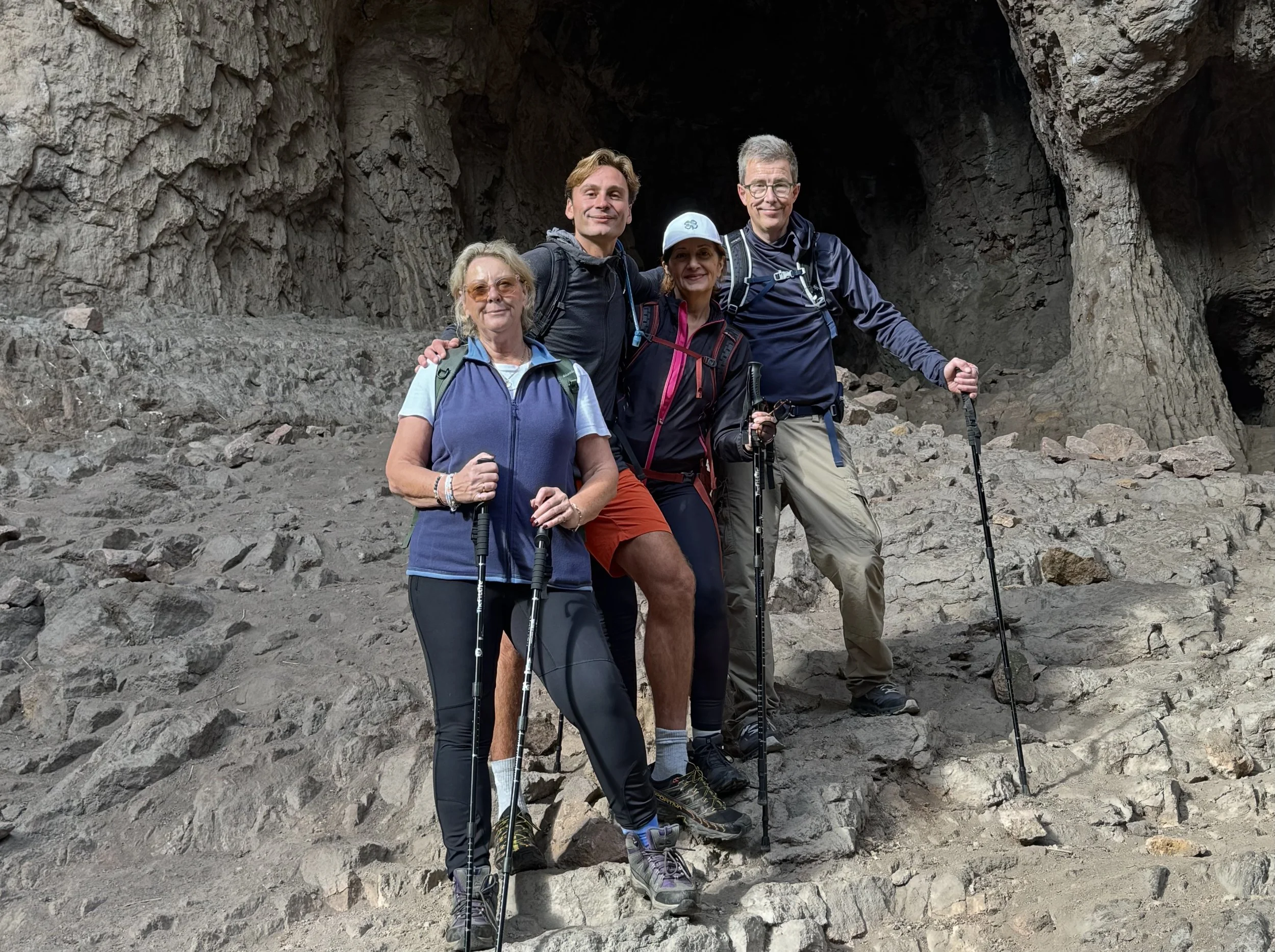
![Four hikers standing on rocky terrain inside a mountain cave, smiling at the camera, wearing backpacks, hiking gear, and holding trekking poles.]()
Hiking Group
-
![A forested landscape with tall pine trees, rocky cliffs in the background, and a blue sky with wispy clouds.]()
Rock Formations on Gorges du Blavet Hike


Some of our hiking routes
Below are some of our featured hiking routes in their full form, many of which can be shortened or adapted to suit the group, conditions, and overall pace of the retreat.
-
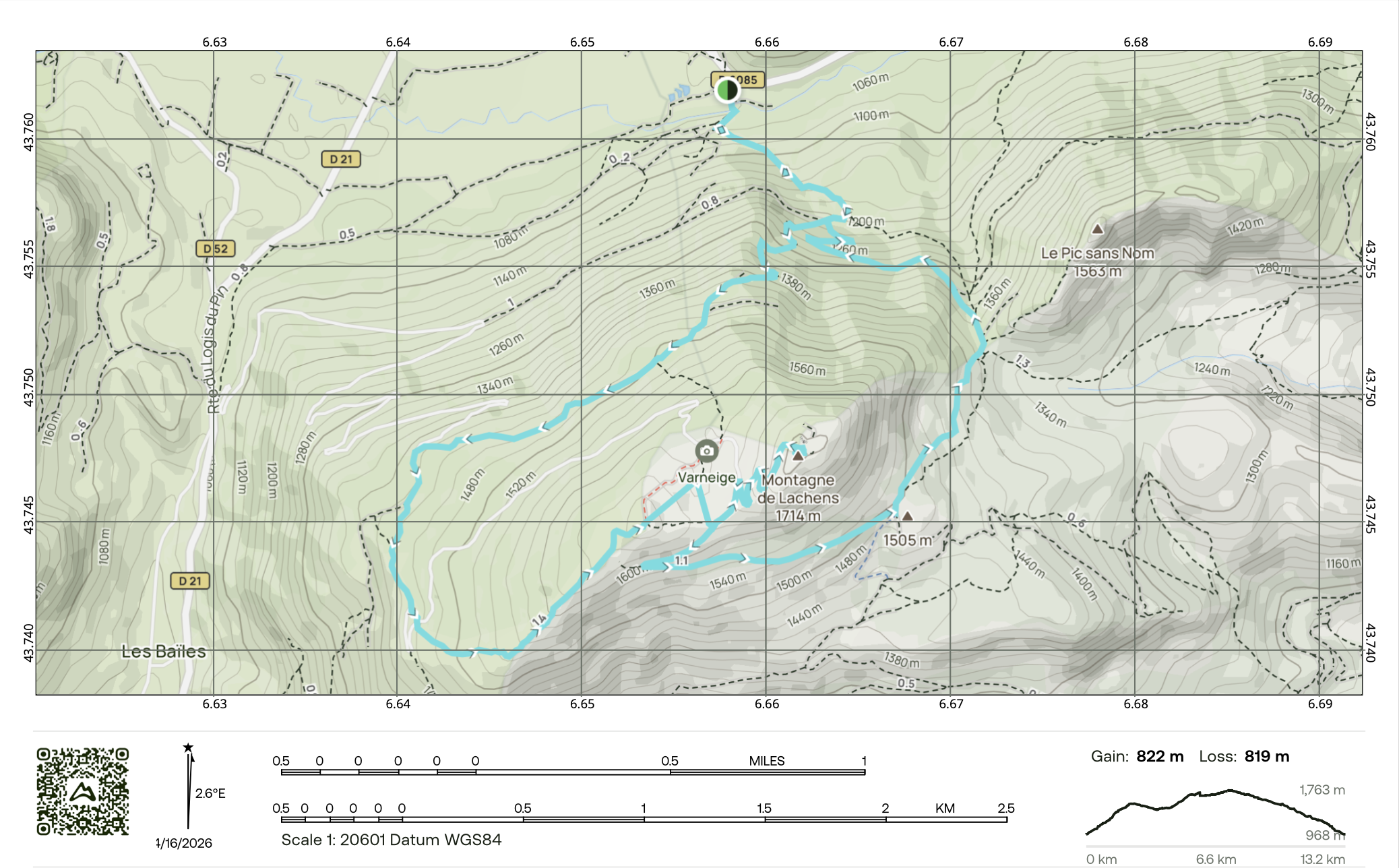
Rising to 1,715 metres, Montagne de Lachens is the highest point in the Var and one of the great panoramic summits of inland Provence. Its broad, open crest offers an extraordinary sense of space, with views stretching across much of the region - from the Sainte-Baume massif to the west and the Mercantour to the east, all the way to the Mediterranean to the south.
We begin our hike on the northern side of the mountain, where the trail leads us through dense pine forest and into a quieter, more sheltered side of the landscape. The first part of the walk has a wonderfully immersive feel, with winding paths, cool woodland air, and that gradual sense of climbing into bigger mountain scenery. As height is gained, the forest begins to thin in places and openings in the trees reveal increasingly wide views across the western reaches of the Var.
Higher up, the character of the mountain changes. The woodland gives way to more open terrain of grass, rock, and low mountain vegetation, with the broad upper slopes of Lachens creating a striking contrast to the enclosed forest below. In summer, these exposed sections feel wonderfully expansive, with wild lavender blanketing the western mountain top and open skies adding to the sense of being high above the surrounding hills and valleys.
As we approach the top, the views become increasingly spectacular until we reach the summit area of Montagne de Lachens itself. From here, the panorama is truly exceptional - a full mountain-and-sea sweep across Provence. It is the perfect place to stop for lunch, enjoy the fresh mountain air, and take in the rare feeling of standing on the highest ground in the entire department.
After lunch, we descend by a different route, moving onto the southern side then eastern side of the mountain. Looping around the mountain in this way reveals a different aspect of Lachens, with changing light, broader horizons, and a final walk through the beautiful pine forests that lead us back to the van.
-
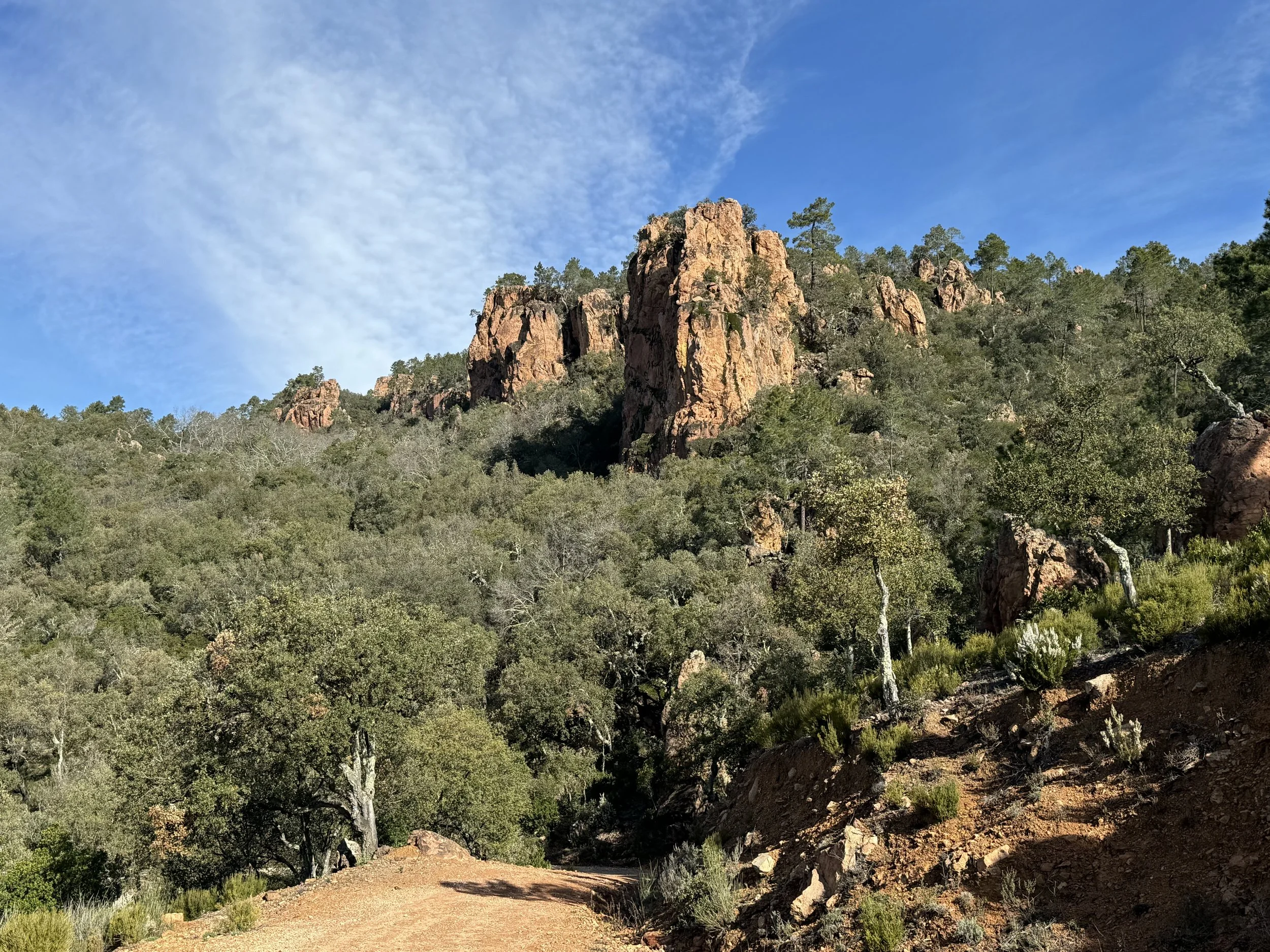
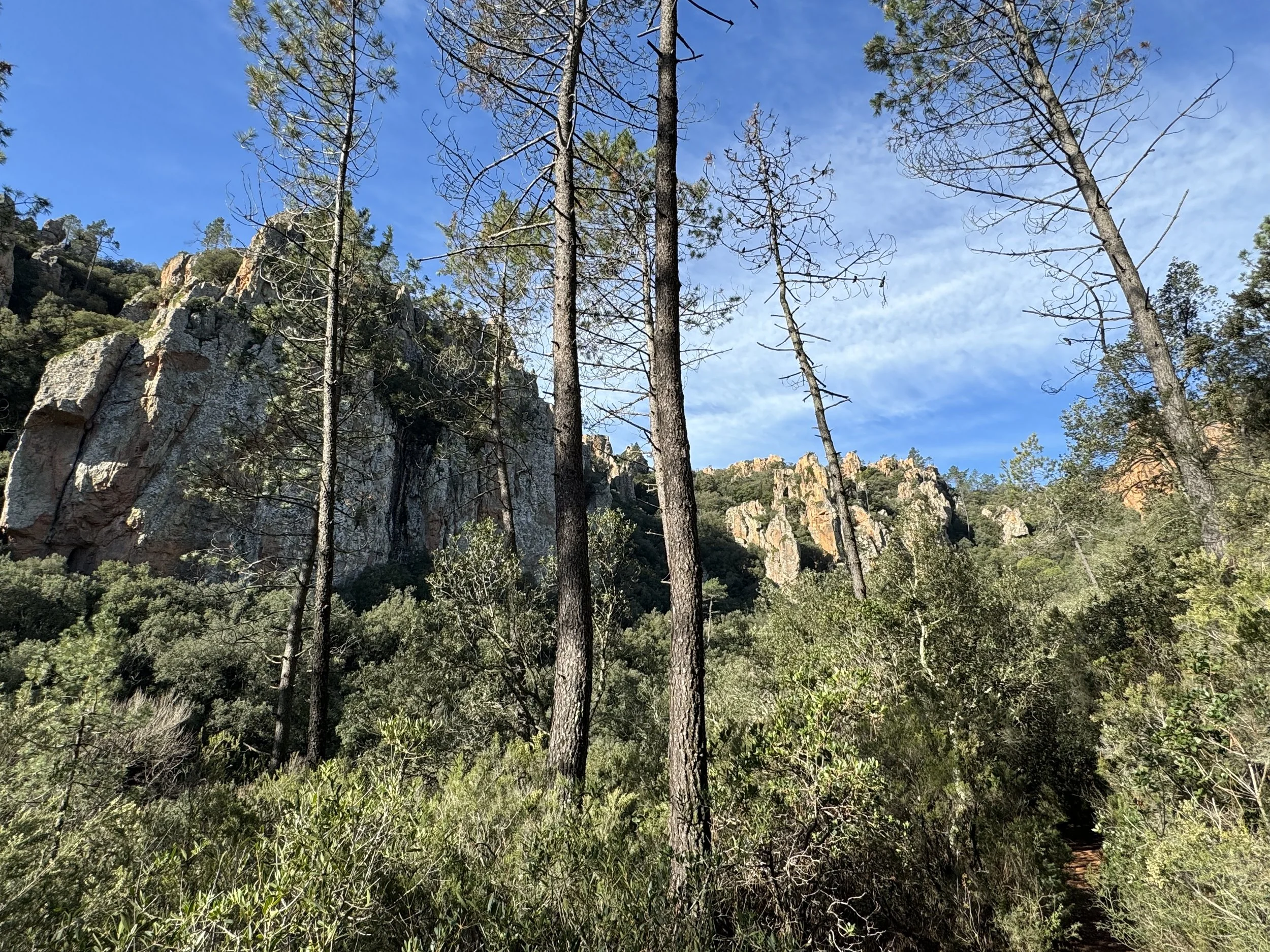
Carved into a striking corridor of red volcanic rock near Bagnols-en-Forêt, the Gorges du Blavet offers one of the most distinctive landscapes in this part of Provence. The Blavet River has gradually cut its way through cliffs and rocky outcrops rich in iron, giving the porphyry and rhyolite a deep golden-red hue that glows beautifully against the surrounding forest and blue Provençal sky. The result is a landscape of jagged rock faces, sculpted formations, caves, and hidden ledges - dramatic in appearance, yet still softened by the pines, oaks, and Mediterranean vegetation that cover the valley floor and climb the slopes around it.
We begin our hike on forest trails close to the river, where the route leads us gently into this extraordinary natural setting. The opening section has a wonderfully immersive feel, with woodland paths, glimpses of red stone through the trees, and the quiet presence of the gorge unfolding gradually around us. Before long, we reach the remarkable Grotte du Muéron, a vast prehistoric cave hollowed into the rock, known for its impressive entrance and high ceiling. The site is associated with very early human occupation, with traces of human presence here dating back around 10,000 BC to 12,000 years ago.
Shortly after the cave, the trail rises more steeply for a brief section, bringing us up to a first superb viewpoint. From here, the scenery opens dramatically, revealing the contrast that makes the Blavet so memorable: red rock walls, dense green forest, and, in the distance, the shimmer of the Mediterranean.
We then continue across the quieter hills and forests above the gorge, following a route that feels peaceful and remote despite the breadth of the views.
After a couple of hours of walking, we arrive at another beautiful viewpoint where we can stop for lunch and take in the wide Provençal scenery around us. From here, you can look out across the surrounding hills towards perched villages in the distance. After lunch, we briefly retrace our steps before following a winding trail back down towards the van.
-
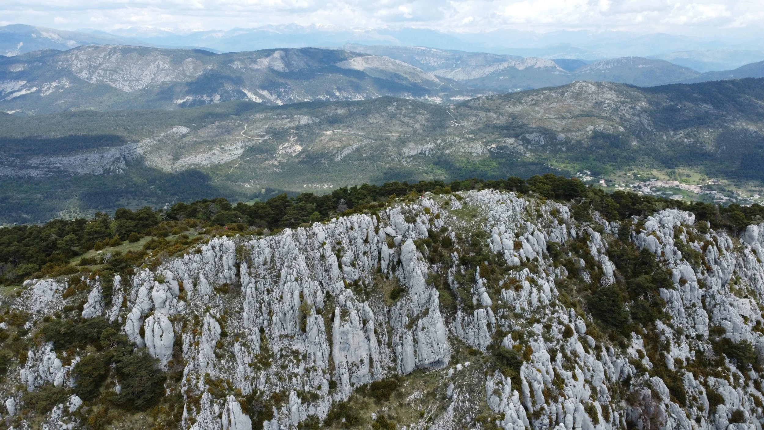
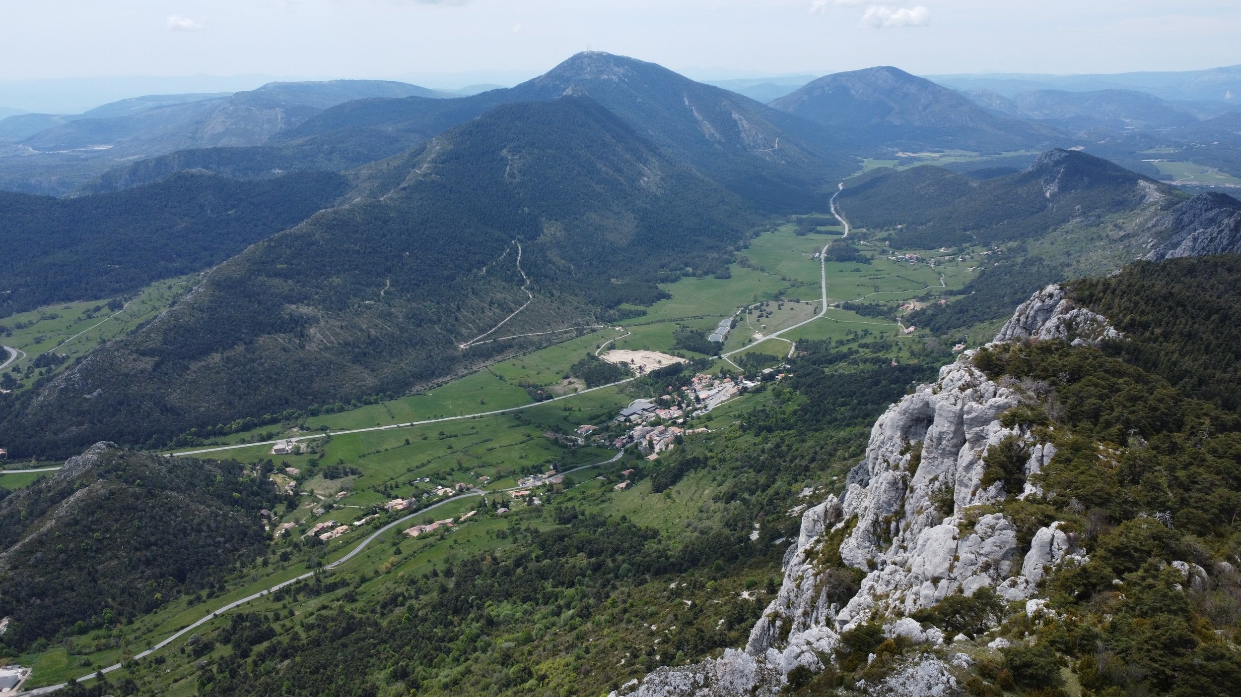
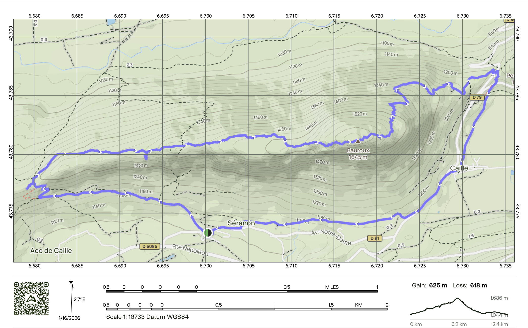
Set within the eastern reaches of the Parc naturel régional des Préalpes d’Azur, the Montagne de Bauroux rises above Séranon as one of the great panoramic ridges of this part of the Alpes-Maritimes. Reaching around 1,644 metres, this striking limestone mountain stretches east to west above the surrounding valleys and has long held both strategic and historical importance, having served as a place of refuge from Neolithic times through to the Middle Ages. Today, it offers a magnificent hike combining open mountain scenery, wooded trails, sweeping ridge walking, and a fascinating sense of the region’s past.
We begin in the village of Séranon, close to the famous Route Napoléon - the historic road linking the coast to the Alps and associated with Napoleon’s return through the region in 1815. From here, the trail heads out beneath the mountain, gradually drawing us into the quieter, more expansive landscapes of the high Préalpes. The opening section already offers a lovely sense of space, with wide views over the surrounding countryside and the long limestone backbone of Bauroux rising above.
As we climb, we reach Vieux-Séranon, the evocative remains of the old fortified village, where ruins from the 12th and 13th centuries still sit beneath the ridge. This gives the walk a special character, adding a strong historical thread to the mountain setting. From here, the route continues upward through woodland on the northern side, passing through a changing landscape of rocky sections and forest, as we approach the crest. It is a varied and rewarding ascent, with the scenery becoming increasingly dramatic as height is gained.
The trail then leads us onto the higher ground of Bauroux, where the reward is a superb 360-degree panorama across the Préalpes d’Azur and the surrounding mountain ranges. From the summit and ridge, the views are wonderfully expansive, with rolling valleys, limestone peaks, and distant alpine horizons unfolding in every direction. It is the perfect place to pause, enjoy a packed lunch, and take in the clarity, silence, and fresh mountain air that make this hike feel so uplifting.
After our stop at the top, we begin the descent around the eastern side of the ridge, following a loop that reveals yet more changing perspectives over the landscape. Lower down, the trail passes near Caille, a small mountain village whose stone buildings and quiet setting add another gentle note of local character to the day. From there, we continue back towards our starting point, returning with that satisfying feeling of having experienced a hike that blends natural beauty, history, and some of the finest ridge views in the region.
-
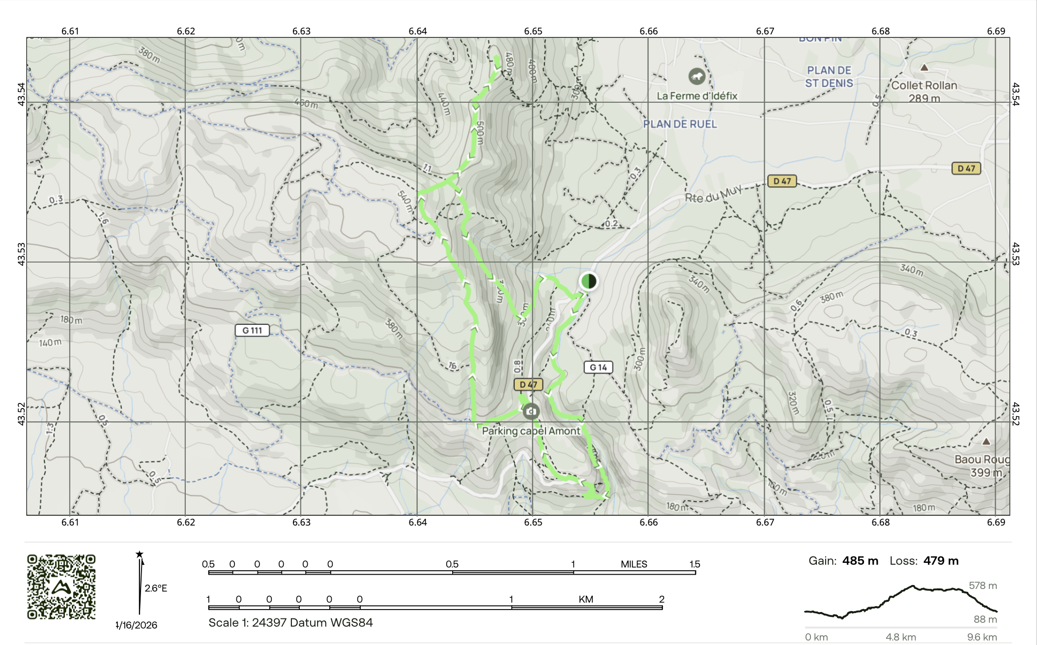
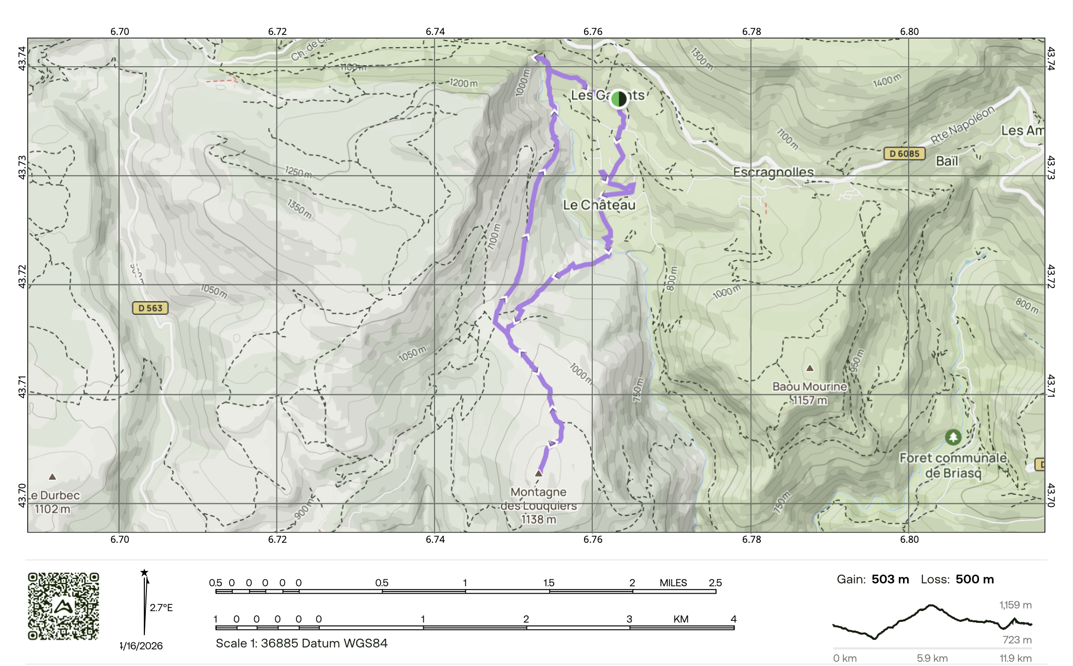
Starting near the village of Escragnolles in the Préalpes grassoises, this beautiful circular hike offers one of the most varied and rewarding walks in the area, combining forest trails, rocky slopes, far-reaching views, and one of the region’s most striking waterfalls. The route leads up to the Montagne des Louquiers, whose summit reaches around 1,137 metres, before looping back down through a hidden, greener side of the landscape to the spectacular Cascade de Clars. With its mixture of open viewpoints, woodland atmosphere, and flowing water, it is a wonderfully complete day in nature.
We begin close to Escragnolles, following paths that quickly draw us into a quieter mountain world of pine woodland, limestone terrain, and gently changing scenery. The trail passes through a rich mix of landscapes, at times shaded and enclosed beneath the trees, and at others opening onto more rugged, stony sections with a stronger alpine feel. This variation is part of what makes the walk so special - it constantly shifts in character as we gain height, giving the hike a real sense of journey rather than simply a climb to a summit. The full loop is typically around 12 kilometres with roughly 500 metres of ascent, making it a moderate but very rewarding outing.
As we continue upwards, the trail leads us to the summit of Montagne des Louquiers, where the reward is a superb panorama across the surrounding pre-Alpine ridges and valleys. On clear days, the views stretch all the way to the Mediterranean coast. It is a wonderfully uplifting summit, with that rare contrast between mountain stillness and the distant shimmer of the sea.
From the top, we begin our descent into a more hidden and sheltered side of the landscape, where the atmosphere becomes softer and greener again. As we descend, the scenery gradually changes from exposed mountain ground back into a cooler, more enclosed valley environment, with beautiful trees, damp stone, and a wilder, more intimate feel.
Towards the end of the hike, we reach the real highlight of the final section: the Cascade de Clars, a striking waterfall of around 40 metres that spills from the rock into a beautiful pool below. Set within a natural amphitheatre and this is an ideal spot for a refreshing swim, it is a spectacular and memorable place to pause before the final and short stretch back to the van.
-
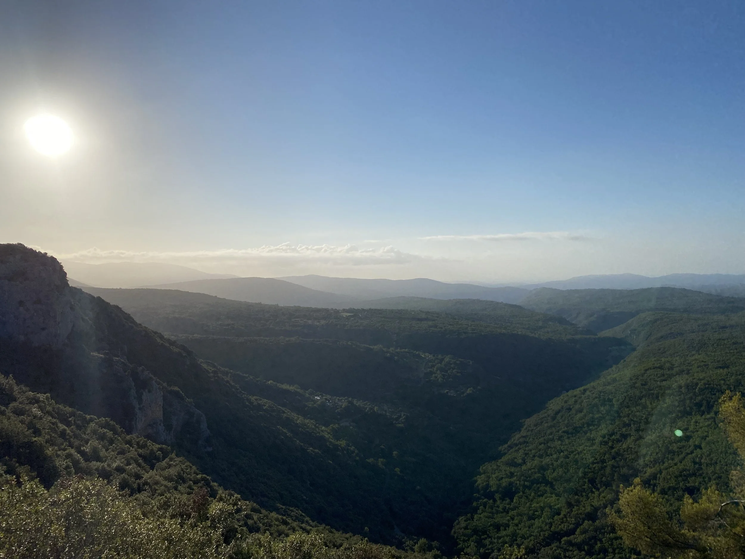
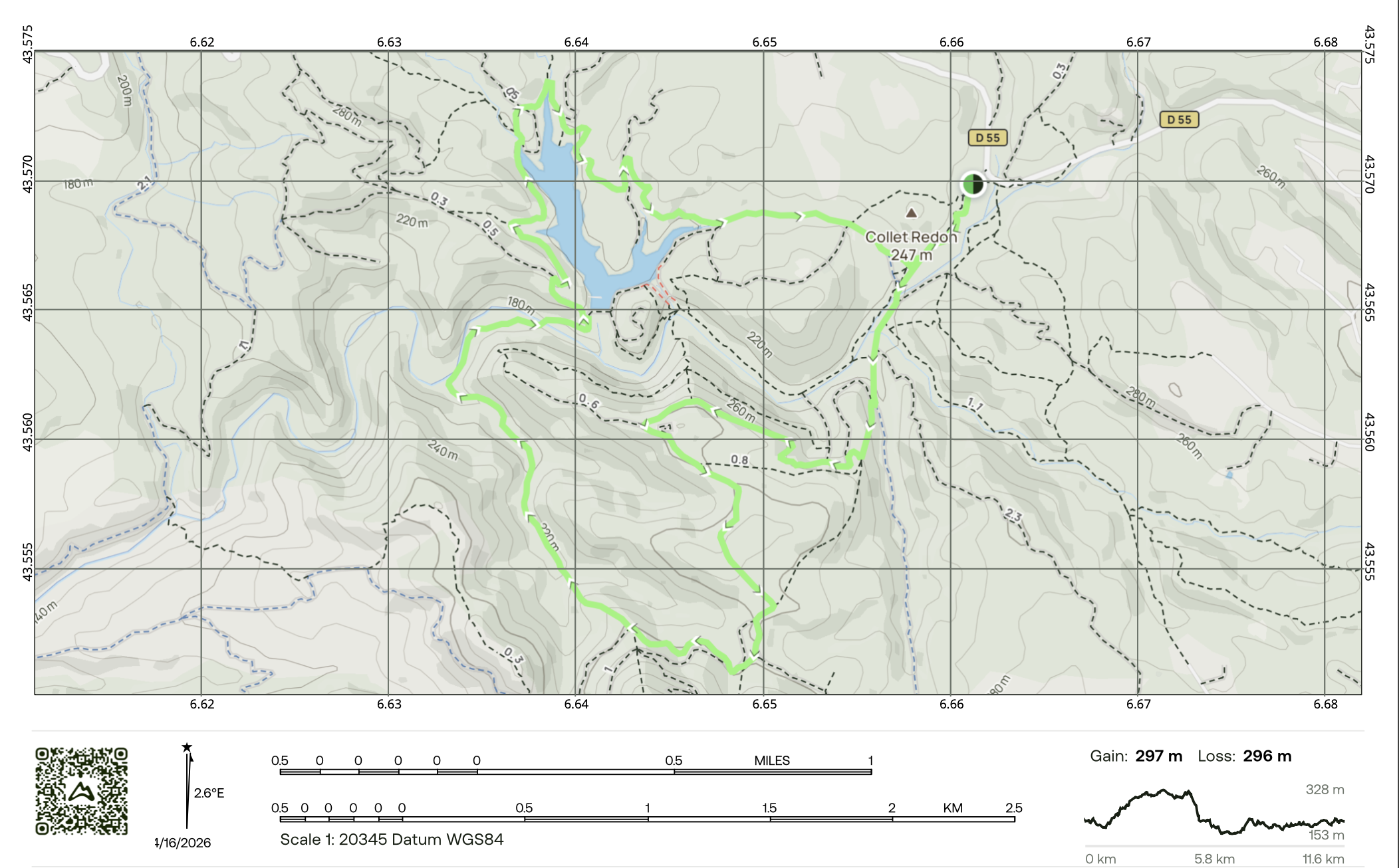
Tucked away between the Massif des Maures and the forested hills of Fayence, Seillans, and Saint-Paul-en-Forêt, the Lac de Méaulx hike offers a wonderfully peaceful escape into one of the greenest and most tranquil corners of inland Provence. This scenic loop leads to the lake through a landscape of dense woodland and gentle rolling terrain, where pine, oak, and Mediterranean vegetation create a feeling of calm and seclusion throughout the walk. The lake itself, covering around 11 hectares, sits quietly within this richly wooded setting, giving the whole route a serene, almost hidden quality.
We set off along winding forest trails, following peaceful paths beneath the shade of pines and oaks, with the scent of resin, dry earth, and wild herbs warming in the Provençal sun. The route rises gently, never feeling too demanding, and allows you to settle into the rhythm of the walk while taking in the stillness of the surrounding landscape. This is a softer, more immersive kind of hike - less about dramatic altitude and more about the quiet beauty of nature, birdsong, filtered light, and the feeling of being deep within the woods.
As the trail continues, the trees begin to open and the first glimpses of the lake appear through the forest - calm, reflective, and beautifully still. The lake was created as a hillside reservoir and has become a lovely natural-feeling retreat, blending quietly into its surroundings despite its practical origins.
Eventually, we arrive at Lac de Méaulx itself, a secluded expanse of water cradled by forest and low hills. It is the perfect place to pause, enjoy a bite to eat, and take in the stillness of the setting. The atmosphere here is wonderfully restorative - calm water, birds overhead, and the sense of being far removed from the busier parts of the coast. We then continue on the looping trail around the lake, enjoying changing perspectives over the water and woodland as we make our way back towards the starting point.
-
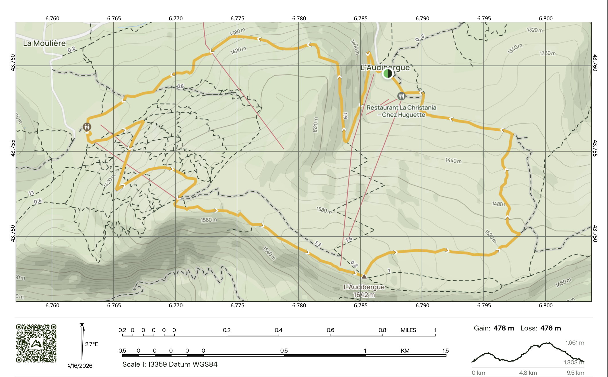
L’Audibergue, rising to around 1,642 metres, is one of the great panoramic summits of the western Alpes-Maritimes, perched between the Préalpes d’Azur and the first southern reaches of the Alps. Reached from the mountain station on its northern side, this beautiful limestone peak offers one of the most rewarding viewpoints in the region, with sweeping views over the Mercantour mountains, the Mediterranean, the Estérel, and on especially clear days, even Corsica shimmering on the horizon. Its broad ridgeline and open summit create a wonderfully airy mountain experience, with a real sense of space in every direction.
We begin our hike at the ski station on the north side of the mountain, where the trail leads us gently into cool alpine forest. The first section of the route feels peaceful and sheltered, weaving through pines and mountain vegetation. As we leave the trees behind and move around towards the western side of the mountain, the landscape begins to open dramatically, revealing the limestone slopes and the wider mountain world beyond.
From here, we begin the final climb towards the summit of L’Audibergue, following a striking mountain trail up onto the crest. The reward at the top is extraordinary: a full 360-degree panorama. It is one of those summits that feels both expansive and uplifting, with remarkable views in every direction.
We’ll pause near the summit to take in the scenery and enjoy our lunch in this spectacular setting. The ridge itself is a real highlight of the day, broad and open in places, with that wonderful sense of walking high above the surrounding valleys and hills. This part of the hike captures everything that makes L’Audibergue so special - mountain air, wide skies, and a rare meeting point between the Alps and the Mediterranean.
We then continue across the top ridge trail, following the crest as the route loops back down the mountain. The descent brings us gradually back towards the ski station, with ever-changing perspectives of the surrounding landscapes. Returning to the van after completing the circuit, the hike leaves you with the feeling of having experienced one of the most scenic and uplifting mountain walks in this part of southern France.


